
Download or view Buckley’s Guide to enjoy exploring the distinctive, charming, and frequently historic towns and villages nestled in North East Victoria.
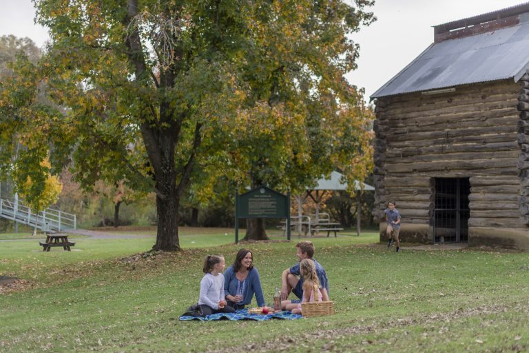
Immerse yourself in the charming and scenic towns and villages found here. From secluded hamlets to rural cities, discover heritage streetscapes steeped in history, innovative dining experiences, and abundant cycling opportunities, all amidst the backdrop of majestic natural attractions. Buckley’s Guide encompasses restaurants and cafés, specialised shops, services, wineries, breweries and distilleries and many activities all unique to the area.You are now in one of the jewels of Victoria’s rural crown.
Please enjoy the relaxed ambience as you dine, shop and explore our breathtaking alpine views, historic towns, broad river plains and sweeping rural landscapes. As each season has its own special character, there is always a reason to be here.
Thanks for traveling along with us together with your Buckley’s Guide.
Google map at bottom of page for your convenience.
Alpine and Indigo Shires
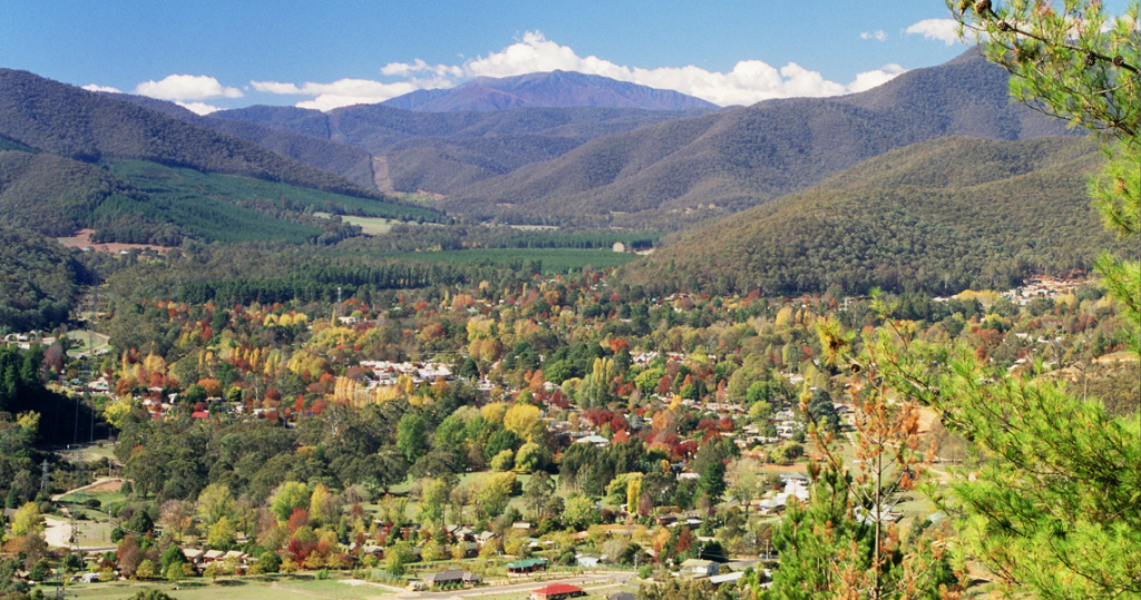
Bright and surrounds
History: In 1824, the region was explored by Hamilton Hume and William Hovell, who bestowed the name Ovens River on the area.
Originally known as Morse’s Creek, named after F.H. Morse, the town underwent a name change in 1861 to honor the British orator and politician John Bright. The Post Office, initially established as Morse’s Creek in 1860, underwent a renaming to Bright in 1866.
Amidst the Victorian gold rush, there was a surge towards the nearby Buckland River. As gold deposits dwindled, Chinese miners flocked to the area, leading to tensions and the violent Buckland Riot of 1857. The riot, stemming from Chinese success, resulted in casualties and the departure of 2,000 Chinese miners. It was ultimately quelled by the Beechworth police under Robert O’Hara Burke’s command from a distance of 80 kilometers.
Bright boasts a rich cultural heritage, with various locations and street names reflecting the town’s present-day residents. The Bright Historical Society preserves extensive records of the region’s history, while the Bright Magistrates’ Court closed its doors on January 1, 1990.
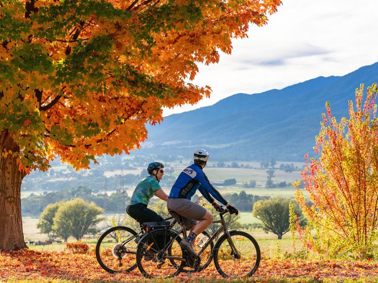
As of the early 21st century, tourism is the primary industry in Bright, with a focus on showcasing the autumnal colors of European trees in the area. The Bright Autumn Festival is a significant cultural event. The town has become a hub for paragliding festivals and competitions due to its proximity to numerous launch sites.
Serving as a gateway to alpine scenery, Bright features native birds and animals, with Morses Creek and the Ovens River offering walking tracks of various lengths. During summer, the town experiences a population surge, particularly after Christmas, attracting families seeking warm and sunny days.
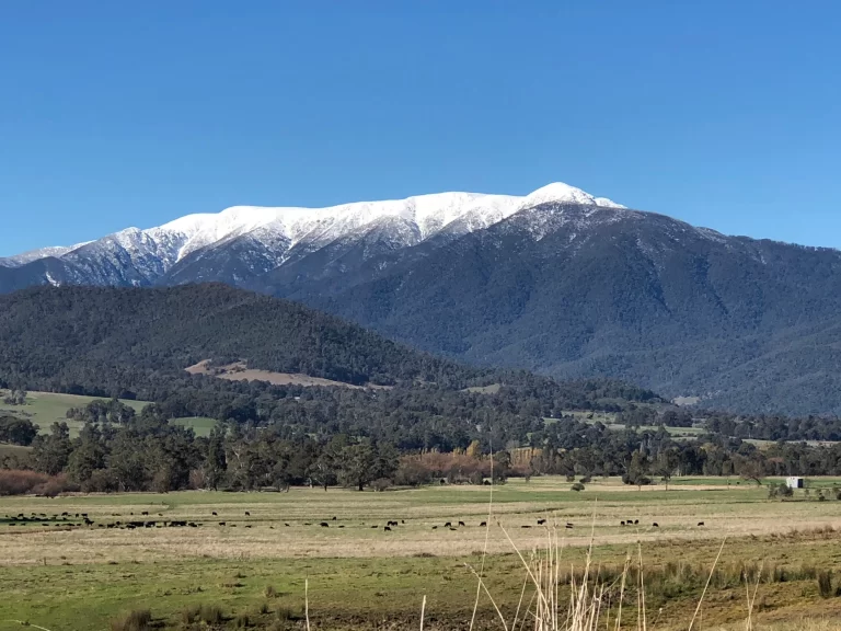
Bright is situated close to the Victorian Alps and several alpine national parks, including Mt Buffalo National Park, Mt Feathertop, Mt Bogong, and Mt Hotham. Mt Bogong, at 1986 meters above sea level, is the highest peak in Victoria, with mt Feathertop as the second-highest at 1922 meters.
The preserved railway station now serves as a local history museum. Although trains no longer run, the Murray to the Mountains Rail Trail allows cyclists to traverse the same route through Myrtleford, Beechworth, and Wangaratta.
Bright experiences a temperate climate under the Köppen classification, marked by distinct seasons. Summers are warm and dry with cool nights, autumns are mild and damp, while winters and springs are characterized by chilling rains. Frost is common throughout the year, with occasional winter snowfall. The highest recorded temperature in Bright was 40.7 °C on February 8, 1983, and the lowest recorded temperature was −7.8 °C on June 30, 1986.
Education: Situated within walking distance of the town center, Bright P-12 College serves students from the neighboring townships of Porepunkah, Harrietville, and Wandiligong.
Flora and Fauna: The local area boasts a diverse range of plants and animals, with wildflowers, trees, undergrowth, and ferns co-existing in close proximity. Within a short walk of the town centre, natural habitats host platypus, fish, yabbies, and amphibians. Overhead, dragonflies, native bees, willy wagtails, kookaburras, magpies, and cockatoos, among other bird species, are commonly observed. Lyrebirds are heard outside of town, and wombats and the occasional echidna can be spotted. Various small reptiles, including lizards, inhabit the area.
Sport: Popular activities in Bright include hang-gliding and paragliding, with the Mystic Flight Park located 3 kilometers from the town. Fishing is a common pursuit in the rivers and dams, stocked with trout from the local hatchery. Mountain biking trails, ranging from technical single tracks to easy river-side rides, are found close to the town centre.
Local Attractions: The town and its surroundings offer a range of attractions, including farms, wineries, historic sites, fruit orchards, restaurants, and the exploration of the natural landscape and surrounding mountains. Bright hosts numerous events, such as markets, festivals, mountain bike events, horse endurance rides, art exhibitions, fireworks, and concerts throughout the year.
Transport: Access to Bright is via the Great Alpine Road, connecting to the Melbourne-to-Sydney Hume Freeway or the Murray Valley Highway. Air access is available through small aircraft landing strips at Mount Hotham Airport and Porepunkah Airport. The former Bright railway line, closed in the 1980s, has been converted into the Murray to the Mountains Rail Trail.
Media: Radio stations such as Valley FM, ABC Classic FM, Triple J, ABC Goulburn Murray, and Alpine Radio contribute to the vibrant media landscape in Bright. Television options include ABC, Prime7, SBS, Southern Cross 10, and WIN Television.
What's on in Bright
Wandiligong
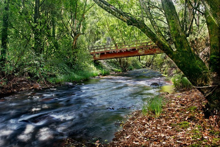
Wandiligong, a small historic village, is located just south of the Alpine holiday town of Bright. The town’s rich gold history is evident in its historical buildings, including the Manchester Unity public hall, general store, churches, and charming cottages. Nestled in a picturesque valley surrounded by forests and mountain ranges, Wandiligong features Morses Creek, with a scenic walking track tracing its course all the way to Bright.
“The Diggings,” accessed via Centenary Avenue, offers a glimpse into Wandiligong’s gold rush past, featuring extensive mining sites beautified with walking tracks and footbridges across Morses Creek and Growlers Creek. Noteworthy is the Chinese Swing Bridge, paying homage to the significant Chinese community that once thrived in Wandiligong during the gold rush era.
A delightful scenic drive unfolds along Morses Creek Road, passing landmarks such as the iconic Wandi Pub, meandering across Morses Creek, and traversing a valley adorned with fruit orchards and farms. Another worthwhile route is along School Road, offering views of Wandiligong Primary School, established in 1860, and a scenic ridge that provides captivating vistas of the town against a backdrop of forested mountains.
What's on in Wandiligong
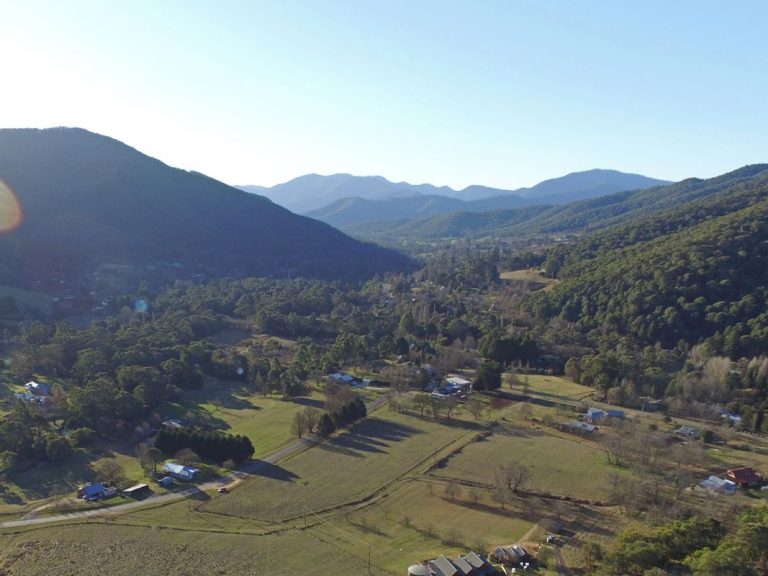
Harrietville
Situated 25 kilometers south of Bright on the Great Alpine Road and nestled at the base of Mount Feathertop in the picturesque Victorian Alps, Harrietville stands as a former gold-mining town.
The town’s allure is particularly pronounced in autumn when the vibrant hues of its diverse deciduous trees create a breathtaking display. The Ovens River gracefully winds its way through Harrietville, bordered by charming parks, including Pioneer Park, showcasing a museum and exhibits detailing the region’s rich history. A compact commercial center comprises a general store, two hotels, and various accommodation options.
Just 10 kilometers north along the Great Alpine Road lies the quaint community of Smoko. Aptly named after numerous expansive tobacco farms that once adorned the road and Ovens River, Smoko sits in a picturesque valley surrounded by berry farms, nut plantations, forests, and mountains.
Harrietville is conveniently close to the major Alpine ski resort of Mount Hotham, providing year-round activities for visitors.
King Valley
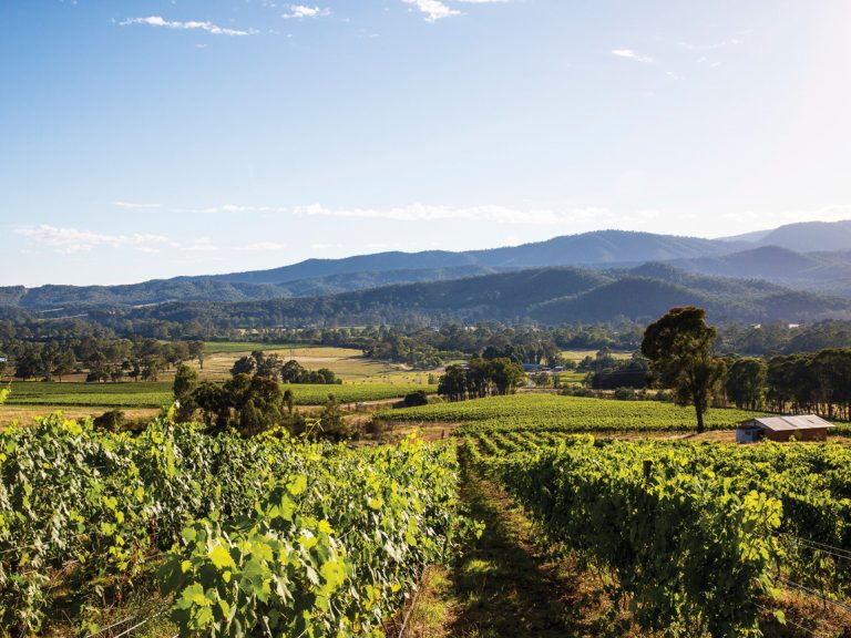
The King Valley, also known as the King River Valley, is an agricultural and wine-producing region situated between Wangaratta and the Alpine National Park in the North East Victoria area of the Australian state of Victoria. Numerous small towns, including Cheshunt, Whitfield, King Valley, Edi, Claremont, Moyhu, Byrne, Docker, and Oxley, are nestled within this scenic region. The designation of King Valley as an Australian Geographical Indication protected name occurred on October 12, 2007.
Since the 1880s, the fertile valley has been utilized for growing various crops, including hops and tobacco, alongside dairy and beef cattle production. A narrow-gauge railway connecting Wangaratta and Whitfield was constructed in 1889, and a government tobacco research farm was initially established in Edi before relocating to Whitfield in 1902. Post-World War II, the area witnessed an influx of Italian, Yugoslav, and Spanish migrants who settled and established tobacco farms. However, with the decline and eventual demise of the tobacco industry in 2006 due to government deregulation, local farmers diversified into crops such as chestnuts, hops, berries, and the establishment of several vineyards.
The history of the King Valley includes episodes involving bushrangers, Chinese and Italian immigration. Chinese migrants, arriving in the mid-19th century from the Goldfields, engaged in careers as market gardeners, tobacco growers, and merchants. Many roads in the Valley today bear the names of prominent families like Mahlooks, Honey, Laffy, and Fosangs. Italian migrants arrived in the 1940s and 1950s, initially pursuing tobacco farming but eventually transitioning to the production of European wine varietals. The Valley gained recognition as a wine region, particularly for varieties such as sangiovese, nebbiolo, and barbera. Notably, some of the highest altitude vineyards in Australia, reaching around 800 meters (2,600 ft), are located on the Whitlands Plateau at the southern end of the region, while Milawa, at the northern end, sits at an altitude of 155 meters (509 ft).
Milawa
Milawa, situated in Victoria, Australia, along Snow Road, lies 18 kilometers (11 mi) southeast of Wangaratta within the Rural City of Wangaratta. As per the 2021 census, Milawa boasted a population of 588. Positioned at the northern end of the King Valley wine region, Milawa is nestled between the King River to the west and the Ovens River to the north, both converging in Wangaratta. Serving as the central hub of the Milawa Gourmet Region, the town offers a diverse range of produce.
Renowned as the home of the historic Brown Brothers vineyards, in operation since 1889, Milawa also houses the Milawa Cheese Company and Milawa Mustards. Initially known as “The Square” until 1873, the name Milawa has Aboriginal origins, combining ‘Mila,’ meaning ‘Eyes,’ and ‘Wah/Wa,’ meaning water. The Bpangerang people in the Milawa area were known as water watchers, closely monitoring the King River (Poodumbia) and the Ovens River (Torryong).
In its early days, Milawa featured the Emu Hotel, constructed by James Henley, and the Commercial Hotel, built by Colin Gardner. General merchandise was available at McKenzie’s store, and the town boasted two blacksmiths, a saddler, a bootmaker, a carpenter, and a doctor, Dr. McSweeney. The Post Office, initially named Oxley until 1870 and Oxley Plains until 1874, opened on July 7, 1862.
In 1889, a Mechanics Institute with a free library and a spacious hall was established. Football and cricket gained organized play in the 1890s, and Milawa was connected to electricity from the Kiewa hydro scheme in 1939. Notably, a violent storm wreaked havoc in 1977, destroying the Anglican church, damaging numerous buildings, and demolishing crops. A similar storm in 2000 followed a comparable path with analogous outcomes.
Milawa’s rich history includes the establishment of a dairy company in 1891, which, by 1896, had become one of the largest dairy companies in Australia (the Milawa Cheese Company now occupies this site).
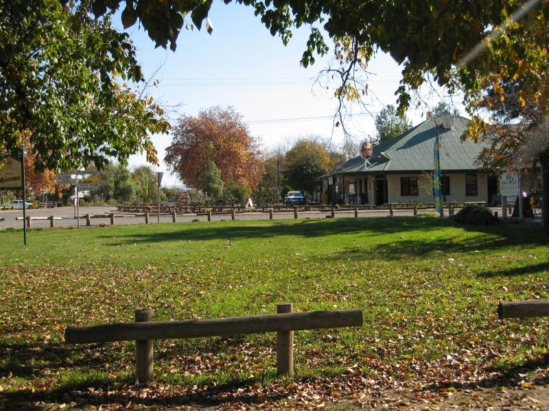
Glenrowan
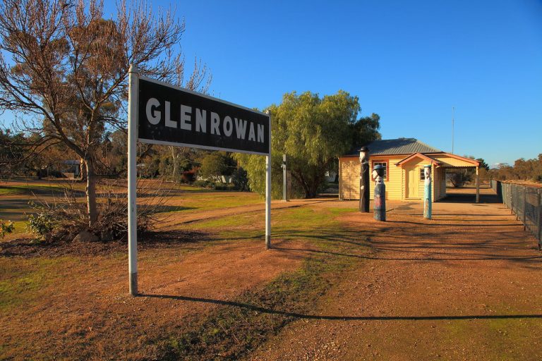
Glenrowan is renowned for being the site of the final siege and capture of the Kelly Gang in 1880, a narrative that is carefully preserved in the town’s attractions, museums, and historic walk. However, beyond Ned Kelly and his iconic armor, Glenrowan offers a multifaceted experience.
Take a leisurely stroll through the town using the Glenrowan Heritage Siege Precinct walking map, available at the Ned Kelly Discovery Hub. This informative guide directs you to key locations such as Ann Jones’ Glenrowan Inn, Police Shelter Site, Gravel Contractors Encampment, Ned Kelly Capture Site, McDonnell’s Railway Tavern, and more.
For those seeking adventure, Glenrowan provides ample opportunities. The neighboring Warby Ovens National Park offers bushwalks with stunning lookout points. Begin your day with a hike up Mt Glenrowan for breathtaking sunrise views or explore the Friends Track, a shared walking/mountain bike trail surrounded by iconic grass trees and forested granite hills, catering to families and adrenaline enthusiasts alike with impressive vistas and technical rock gardens.
Cycling enthusiasts will find Glenrowan appealing with its diverse range of roads catering to varying difficulty levels. Casual Sunday riders can enjoy a rewarding trip to the Winton Wetlands, while those seeking a challenge can tackle the Taminick Loop, a route frequently used for state championships, featuring a steep ascent up Taminick Gap followed by a thrilling descent and scenic country roads.
Glenrowan’s culinary scene offers something for everyone, from charming cafes to bakeries, hotels, and providores. Wine enthusiasts should make sure to visit acclaimed venues like Baileys of Glenrowan, Booths Taminick Cellars (home to Black Dog Brewery), and Morrisons Winery.
During the appropriate season, Glenrowan showcases an array of farm gates and pick-your-own orchards where visitors can harvest cherries, peaches, apricots, kiwi, and various other stone fruit varieties.
Mt Beauty
Mount Beauty, located in north-eastern Victoria, Australia, is a quaint town situated along the Kiewa River at the convergence of the Kiewa Valley Highway and Bogong High Plains Road within the Alpine Shire local government area. Initially established in 1949 by the State Electricity Commission of Victoria to accommodate construction workers involved in the Kiewa Hydroelectric Scheme, the town transitioned to local shire council control in 1967 upon project completion.
The climate in Mount Beauty exhibits distinct seasons, characterized by chilly winters, cool wet springs, warm summers with clear blue skies, and vibrant autumns. Each season offers unique attractions, including skiing, bushwalking, horse riding, gliding, mountain and road biking, fishing in both rivers and lakes, along with hosting an annual music festival, mountain bike competition, and regular weekend markets on the first Saturday of each month. Additionally, the area features numerous four-wheel-drive tracks.
As a launching point for excursions to Falls Creek ski resort and the Bogong High Plains, Mount Beauty boasts several ski hire shops, eateries, and a bus company facilitating daily trips to and from Falls Creek, which is 32 km away. The town offers stunning views of Mount Bogong and other notable peaks, captivating tourists passing through.
With a prominent winter rainfall maximum, Mount Beauty receives an average yearly rainfall of 1,264.6 millimetres, occurring on 142 days concentrated mainly between May and October. Situated at an altitude of 366 metres above sea level, the town experiences a seasonal lag from spring through high summer, offering a distinct climate compared to towns slightly northward, such as Corryong.
Tawonga
Nestled at the southernmost end of the Kiewa Valley, Mount Beauty and Tawonga South, resting at the foot of Victoria’s highest peak, Mount Bogong (1,896m), are rural townships exuding a serene mountain vibe. Established by James Roberts in 1841, the Tawonga pastoral run along the Kiewa River eventually evolved into these charming locales.
By 1880, Tawonga had initiated educational and community facilities, marking its growth. The extension of the railway line to Bright in 1890 enhanced accessibility, while the opening of the Tawonga butter factory in 1901 facilitated agricultural trade.
Around 1910, the Bogong Hotel became a landmark for travelers en route to the Bogong High Plains and Mount Hotham until a tragic fire in 2011. In 1947, Mount Beauty, crafted by the State Electricity Commission of Victoria for the Kiewa hydroelectricity project, emerged. Tawonga South, a key player, hosted the Tawonga South school (1945) for SEC personnel’s children, and new establishments, including an Anglican church (1957) and a caravan park (1958), were introduced during the project.
Post-Kiewa project completion in 1961, the establishment of Falls Creek ski field catalyzed the region’s transformation into a sought-after destination for high plains skiing and walking. Ski hire, accommodation facilities, resorts, and venues flourished in both Tawonga and Tawonga South. However, sawmills, which began operations in 1945-46, ceased their activities.
Today, Mount Beauty and Tawonga South offer a laid-back mountain atmosphere, featuring popular breweries, restaurants, boutique stores, a mountain bike park, and winter snowsports. As ideal bases for Falls Creek snow holidays, they’ve also unveiled their summer allure, inviting outdoor enthusiasts to explore alpine hikes, river walks, mountain biking, road cycling, horse riding, swimming, fishing, scenic flights, and breathtaking lookouts.
Myrtleford
Myrtleford, situated in northeast Victoria, Australia, is positioned 282 km (175 miles) northeast of Melbourne and 47 km (29 miles) southeast of Wangaratta. As part of the Alpine Shire local government area, the town boasted a population of 3,285 in 2021. The post office, initially named Myrtle Creek and established on 26 July 1858, underwent a renaming to Myrtleford in 1871. The Buckland Road, now known as the Great Alpine Road, traverses Myrtleford.
Renowned for its fertile soil, Myrtleford yields an abundance of fresh local produce, including vegetables, berries, nuts, and olives. The town has gained recognition for its vineyards, contributing to the Alpine Valleys wine region, featuring prominent wineries like Michelini Wines and Gapsted Wines. Green spaces such as Jubilee Park and Rotary Park enhance the town’s natural charm..
Arriving in Myrtleford, whether by bicycle through the Murray to Mountains Rail Trail or as a stop on the Great Alpine Road tour, visitors encounter a vibrant village. Exploring the town offers opportunities to savour fresh local produce, visit cellar doors, and delve into the rich goldmining history of the region.
For cycling enthusiasts, the surrounding alluvial flats provide a rich bounty of vineyards, vegetables, berries, nuts, olives, and beef. Bike paths lead to farm gates, inviting visitors to gather freshly harvested produce. Cellar doors and vineyards in the Alpine Valleys wine region beckon wine enthusiasts for tastings of innovative varietals. In the heart of Myrtleford, local restaurants and cafes showcase imaginative preparations of the region’s produce.
Exploring on foot, visitors can obtain a map from the visitor information center and stroll along the Discovery Trail, uncovering Myrtleford’s historical ties to tobacco cultivation and gold mining. A serene pause along the Ovens River offers a picturesque view of Mount Buffalo and the Alps.
Porepunkah
Porepunkah, a tranquil village situated 6km north of Bright along the Great Alpine Road in northeast Victoria, lies at the meeting point of the Buckland and Ovens Rivers. Positioned as the closest town to Mount Buffalo National Park, which majestically graces the southern skyline, Porepunkah serves as the gateway to the picturesque Buckland Valley.
European settlement in Porepunkah dates back to the 1830s, gaining momentum with the discovery of gold in the 1850s. Notably, Porepunkah witnessed the infamous Buckland Riot on July 4, 1857, marking an anti-Chinese race riot.
In the annals of bushranging, the notorious Harry Power made his mark, defying the police in the Ovens district for a decade. In 1869, Power held up the mail coach at Porepunkah after escaping from Pentridge Prison.
Porepunkah has preserved its historical roots, with landmarks like the Porepunkah Primary School, established in 1873, still in operation today. The Porepunkah Recreation Reserve, gazetted in 1895, and the town’s proclamation as a township in 1910 further contribute to its rich history.
During the serene summer months, Porepunkah becomes a cherished family retreat. Riverside Park offers an ideal spot for relaxation, with the Porepunkah River Pool providing a refreshing haven for swimming and water activities. The park, equipped with amenities such as gas BBQ facilities and a picnic shelter, is conveniently located across from the town center.
In winter, Porepunkah transforms into a hub for tobogganing adventures at Mount Buffalo, offering easy accessibility and rental services for ski gear and chains. Whether capturing the enchanting views of Mount Buffalo or exploring its historical landmarks, Porepunkah stands as a gateway to both natural beauty and cultural heritage.